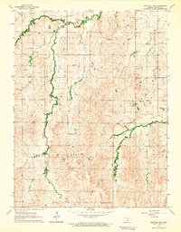
1964 Map of Westfall NW
USGS Topo · Published 1965About this map
Indiana, Valley, and Franklin townships dominate this mid-1960s landscape, where the meandering courses of Bullfoot Creek, Spring Creek, and Elkhorn Creek define the drainage of the Kansas uplands. The sheet reveals a rural community anchored by institutional landmarks such as St John Ch and the nearby St John Sch, located in the northeastern quadrant.
Find a feature on this map
15 named features on this map. Tap any name to fly to it.
Don’t see what you’re looking for? This feature index may not catch every label — zoom into the map to look around manually.
Map Details
Editions of this 1964 Westfall NW Map
This is the sole edition of this map. No revisions or reprints were ever made.
Other maps of this area

1894 · Ellsworth
USGS Topo · 1:125,000

1894 · Beloit
USGS Topo · 1:125,000

1955 · Great Bend
USGS Topo · 1:250,000

1955 · Beloit
USGS Topo · 1:250,000

1957 · Great Bend
USGS Topo · 1:250,000

1957 · Westfall SW
USGS Topo · 1:24,000

1957 · Westfall SE
USGS Topo · 1:24,000

1957 · Black Wolf
USGS Topo · 1:24,000

1958 · Great Bend
USGS Topo · 1:250,000

1959 · Beloit
USGS Topo · 1:250,000