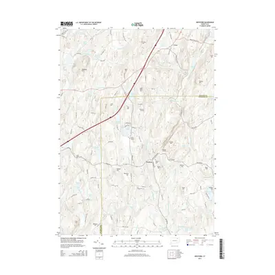
2015 Map of Westford
USGS Topo · Published 2015About this map
The Mount Hope River and Fenton River drain a complex landscape of glacial hills and upland basins along the Tolland and Windham county line. This area of eastern Connecticut is defined by its many bodies of water, including the Stafford Springs Reservoir Number 2, Lake Chaffee, and the appropriately named Morey Pond. Settlement is clustered around the village of Westford, where the Westford Village Cem and Westford Hill Cem serve as focal points for local family history and genealogy. The terrain is marked by significant elevations such as Stickney Hill, Lead Mine Hill, and Walker Mtn. Evidence of historical land use and recreation is scattered throughout the quadrangle, from the Swamp Burying Ground and Moose Meadow Cem to the Westford Airstrip and the Boy Scout Pond located in the southern reaches of the map.
Find a feature on this map
129 named features on this map. Tap any name to fly to it.
Don’t see what you’re looking for? This feature index may not catch every label — zoom into the map to look around manually.
Map Details
Editions of this 2015 Westford Map
This is the sole edition of this map. No revisions or reprints were ever made.
Other maps of this area

1887 · Brookfield
USGS Topo · 1:62,500

1887 · Palmer
USGS Topo · 1:62,500

1889 · Palmer
USGS Topo · 1:62,500

1890 · Brookfield
USGS Topo · 1:62,500

1892 · Woodstock
USGS Topo · 1:62,500

1892 · Tolland
USGS Topo · 1:62,500

1893 · Palmer
USGS Topo · 1:62,500

1893 · Brookfield
USGS Topo · 1:62,500

1908 · Ware
USGS Topo · 1:125,000

1915 · Brookfield
USGS Topo · 1:62,500