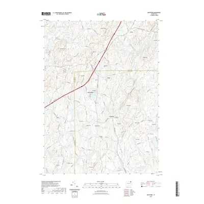
2021 Map of Westford
USGS Topo · Published 2021About this map
Union and the village of Westford serve as the primary nodes of settlement in this part of northeastern Connecticut. The landscape is defined by the winding headwaters of the Mount Hope River and the E Br Mount Hope River, which carve through a series of named elevations including Lead Mine Hill and Walker Mtn. Local infrastructure is concentrated around water resources, from the expansive Stafford Springs Reservoir Number 2 in the northwest to the recreational residential layout at Lake Chaffee. Genealogists will find several burial grounds preserved across the terrain, notably Westford Village Cem and the rural Swamp Cem. The geography also captures the small-scale aviation history of the area through the Westford Airstrip located north of Turkey Hill.
Find a feature on this map
139 named features on this map. Tap any name to fly to it.
Don’t see what you’re looking for? This feature index may not catch every label — zoom into the map to look around manually.
Map Details
Editions of this 2021 Westford Map
This is the sole edition of this map. No revisions or reprints were ever made.
Other maps of this area

1887 · Brookfield
USGS Topo · 1:62,500

1887 · Palmer
USGS Topo · 1:62,500

1889 · Palmer
USGS Topo · 1:62,500

1890 · Brookfield
USGS Topo · 1:62,500

1892 · Woodstock
USGS Topo · 1:62,500

1892 · Tolland
USGS Topo · 1:62,500

1893 · Palmer
USGS Topo · 1:62,500

1893 · Brookfield
USGS Topo · 1:62,500

1908 · Ware
USGS Topo · 1:125,000

1915 · Brookfield
USGS Topo · 1:62,500