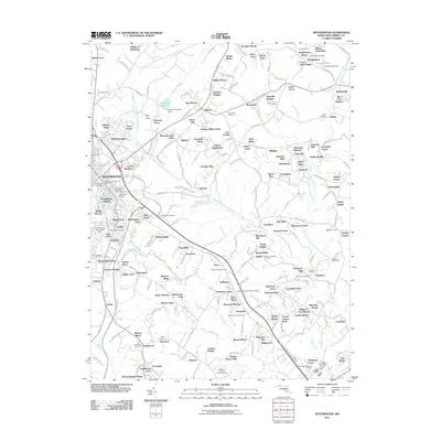
2011 Map of Westminster
USGS Topo · Published 2011About this map
Westminster serves as the hub of this Carroll County landscape, where the West Branch North Branch Patapsco River and East Branch North Branch Patapsco River wind through a complex network of established settlements and newer residential developments. The area is dense with sites of genealogical interest, including the prominent Westminster Cemetery, the Church of the Ascension Burial Ground, and numerous smaller burial sites like Saint Johns Cemetery and the Charity Meeting House Cemetery.
Find a feature on this map
275 named features on this map. Tap any name to fly to it.
Don’t see what you’re looking for? This feature index may not catch every label — zoom into the map to look around manually.
Map Details
Editions of this 2011 Westminster Map
This is the sole edition of this map. No revisions or reprints were ever made.
Other maps of this area

1892 · Ellicott
USGS Topo · 1:62,500

1893 · Frederick
USGS Topo · 1:125,000

1894 · Ellicott
USGS Topo · 1:62,500

1894 · Frederick
USGS Topo · 1:125,000

1905 · Westminster
USGS Topo · 1:62,500

1906 · Ellicott
USGS Topo · 1:62,500

1908 · Patapsco
USGS Topo · 1:125,000

1909 · Mount Airy
USGS Topo · 1:62,500

1911 · Taneytown
USGS Topo · 1:62,500

1942 · Gettysburg
USGS Topo · 1:125,000