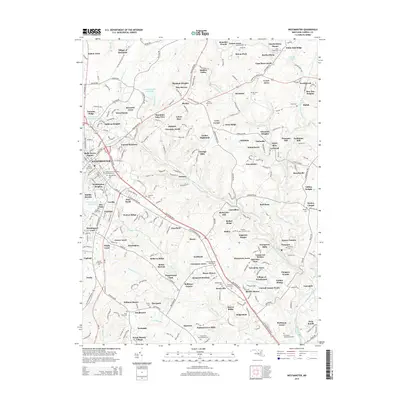
2014 Map of Westminster
USGS Topo · Published 2014About this map
Snydersburg and the Village of Bachman anchor the northern landscape of this Carroll County survey, which reveals a complex network of residential developments and agricultural roots. The central hub of Westminster is depicted with detailed street layouts and significant community sites, including the Westminster Cem and the Carroll Community College campus. Numerous smaller residential enclaves such as Mexico, Brummel, and Shiloh are connected by a web of rural roads like Leisters Church Road and Hampstead Mexico Road.
Find a feature on this map
281 named features on this map. Tap any name to fly to it.
Don’t see what you’re looking for? This feature index may not catch every label — zoom into the map to look around manually.
Map Details
Editions of this 2014 Westminster Map
This is the sole edition of this map. No revisions or reprints were ever made.
Other maps of this area

1892 · Ellicott
USGS Topo · 1:62,500

1893 · Frederick
USGS Topo · 1:125,000

1894 · Ellicott
USGS Topo · 1:62,500

1894 · Frederick
USGS Topo · 1:125,000

1905 · Westminster
USGS Topo · 1:62,500

1906 · Ellicott
USGS Topo · 1:62,500

1908 · Patapsco
USGS Topo · 1:125,000

1909 · Mount Airy
USGS Topo · 1:62,500

1911 · Taneytown
USGS Topo · 1:62,500

1942 · Gettysburg
USGS Topo · 1:125,000