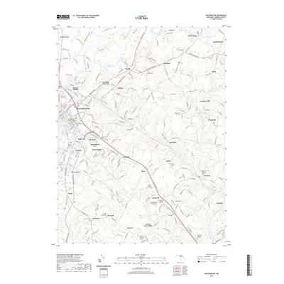
2019 Map of Westminster
USGS Topo · Published 2019About this map
The city of Westminster serves as a dense hub of civic and religious history on this Carroll County landscape. Numerous faith-based sites and legacy burial grounds are documented throughout the area, including the Church of the Ascension and the Westminster Cem. The surrounding countryside is defined by the headwaters and branches of the North Branch Patapsco River, which winds through small crossroads and historic milling sites such as Hoffmans Mill and Tannery.
Find a feature on this map
225 named features on this map. Tap any name to fly to it.
Don’t see what you’re looking for? This feature index may not catch every label — zoom into the map to look around manually.
Map Details
Editions of this 2019 Westminster Map
This is the sole edition of this map. No revisions or reprints were ever made.
Other maps of this area

1892 · Ellicott
USGS Topo · 1:62,500

1893 · Frederick
USGS Topo · 1:125,000

1894 · Ellicott
USGS Topo · 1:62,500

1894 · Frederick
USGS Topo · 1:125,000

1905 · Westminster
USGS Topo · 1:62,500

1906 · Ellicott
USGS Topo · 1:62,500

1908 · Patapsco
USGS Topo · 1:125,000

1909 · Mount Airy
USGS Topo · 1:62,500

1911 · Taneytown
USGS Topo · 1:62,500

1942 · Gettysburg
USGS Topo · 1:125,000