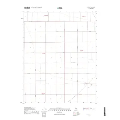
2018 Map of Westside
USGS Topo · Published 2018About this map
San Joaquin Valley agriculture dominates this portion of the Central Valley, where a rigid grid of rural roads and section lines defines the landscape. The small settlement of Westside sits at the junction of W Excelsior Ave and S Lake Ave, representing a localized hub within an expansive territory of industrial-scale farming. Named thoroughfares like W Mount Whitney Ave, W Elkhorn Ave, and S Sonoma Ave reveal the systematic division of the land into large townships and ranges, including t17s r16e and t18s r17e. The topography is exceptionally flat, characteristic of this fertile agricultural belt, where the infrastructure is entirely oriented toward the efficient transport of crops and water management. This detailed record illustrates the intersection of modern logistics and the enduring geography of California's primary farming interior.
Find a feature on this map
25 named features on this map. Tap any name to fly to it.
Don’t see what you’re looking for? This feature index may not catch every label — zoom into the map to look around manually.
Map Details
Editions of this 2018 Westside Map
This is the sole edition of this map. No revisions or reprints were ever made.
Other maps of this area

1912 · Coalinga
USGS Topo · 1:125,000

1923 · Englebrecht Ranch
USGS Topo · 1:31,680

1925 · Helm
USGS Topo · 1:31,680

1925 · San Joaquin
USGS Topo · 1:31,680

1928 · Delta Farms No 3
USGS Topo · 1:31,680

1931 · Wheatville
USGS Topo · 1:31,680

1931 · Towne Oil Station
USGS Topo · 1:31,680

1931 · Mouth of Cantua Creek
USGS Topo · 1:31,680

1932 · Delta Farms
USGS Topo · 1:31,680

1932 · West of Lethent
USGS Topo · 1:31,680