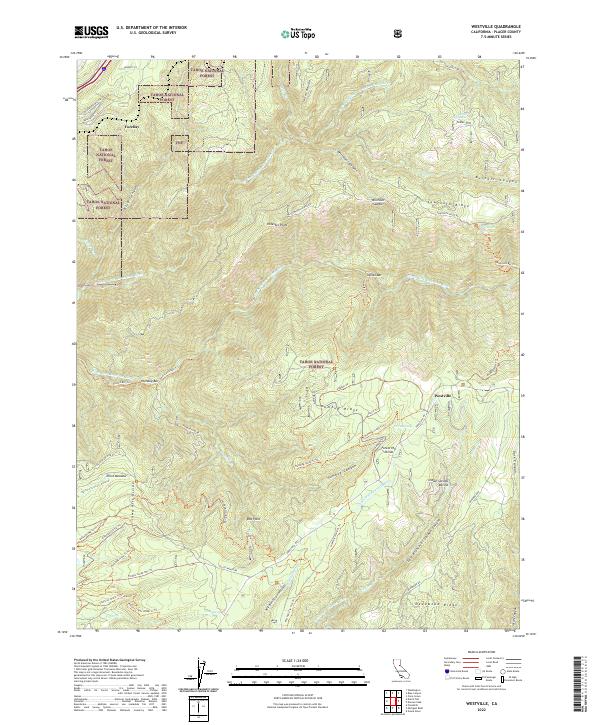
2022 Map of Westville
USGS Topo · Published 2022About this map
The North Fork American Wild and Scenic River carves a deep path through this section of the Tahoe National Forest, defining a landscape where historical water management and mining access remain visible. Early industrial efforts are evidenced by the China Wall Iowa Hill Ditch and the Breece and Wheeler Ditch, which were engineered to move water across complex terrain such as the Iowa Hill Divide. These engineering works, along with the numerous trails like the Mumford Bar Trl and Euchre Bar Trl, reflect the historical pressure to reach river bars including Italian Bar and Humbug Bar.
Find a feature on this map
64 named features on this map. Tap any name to fly to it.
Don’t see what you’re looking for? This feature index may not catch every label — zoom into the map to look around manually.
Map Details
Editions of this 2022 Westville Map
This is the sole edition of this map. No revisions or reprints were ever made.
Other maps of this area

1891 · Colfax
USGS Topo · 1:125,000

1892 · Colfax
USGS Topo · 1:125,000

1894 · Colfax
USGS Topo · 1:125,000

1898 · Colfax
USGS Topo · 1:125,000

1900 · Colfax
USGS Topo · 1:125,000

1902 · Colfax
USGS Topo · 1:125,000

1938 · Colfax
USGS Topo · 1:125,000
1948 · Foresthill
USGS Topo · 1:24,000
1949 · Foresthill
USGS Topo · 1:24,000
1950 · Colfax
USGS Topo · 1:62,500