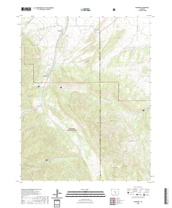
2022 Map of Wetmore
USGS Topo · Published 2022About this map
Wetmore and Greenwood anchor the eastern foothills where the high plains meet the transition into the San Isabel National Forest. This landscape is defined by a dense network of gulches and creeks, including N Hardscrabble Cr and Middle Hardscrabble Cr, which carve through the rising terrain toward the Wet Mountains. The map reveals a complex system of primitive routes and modern connections, such as Co RD 290 and Silom Rd, providing access to high-altitude landmarks like Jackson Hill and the distinctive Bears Head. Notable for local historians and hikers, the sheet details numerous trails including the Mason Gulch Trl and Babcock Hole Trl. The southern portion is marked by the presence of Big Red Butte and Little Red Butte, standing as significant geological sentinels near the border of Custer and Pueblo counties.
Find a feature on this map
56 named features on this map. Tap any name to fly to it.
Don’t see what you’re looking for? This feature index may not catch every label — zoom into the map to look around manually.
Map Details
Editions of this 2022 Wetmore Map
This is the sole edition of this map. No revisions or reprints were ever made.
Other maps of this area

1889 · Canon City
USGS Topo · 1:125,000

1891 · Pueblo
USGS Topo · 1:125,000

1892 · Canon City
USGS Topo · 1:125,000

1894 · Pueblo
USGS Topo · 1:125,000

1896 · Pueblo
USGS Topo · 1:125,000

1897 · Pueblo
USGS Topo · 1:125,000

1954 · Pueblo
USGS Topo · 1:250,000

1957 · Pueblo
USGS Topo · 1:250,000

1958 · Pueblo
USGS Topo · 1:250,000

1959 · Rockvale
USGS Topo · 1:24,000