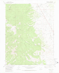
1980 Map of Whale Hill
USGS Topo · Published 1980About this map
Mining claims and high-altitude exploration define this landscape within the Rio Grande National Forest. The map is a dense record of early industrial activity, featuring dozens of specifically named operations such as the Little Darling Mine, Stemwinder Mine, and Colorado Belle Mine. These sites are concentrated along steep drainages like Rawley Gulch and Chloride Gulch, where trails and prospects suggest a history of arduous extraction. An Old Railroad Grade follows the course of San Luis Creek on the eastern edge of the quadrangle, indicating the logistical network once required to service these mountain mines.
Find a feature on this map
43 named features on this map. Tap any name to fly to it.
Don’t see what you’re looking for? This feature index may not catch every label — zoom into the map to look around manually.
Map Details
Editions of this 1980 Whale Hill Map
2 editions found
Other maps of this area

1954 · Pueblo
USGS Topo · 1:250,000

1956 · Montrose
USGS Topo · 1:250,000

1957 · Pueblo
USGS Topo · 1:250,000

1958 · Pueblo
USGS Topo · 1:250,000

1959 · Montrose
USGS Topo · 1:250,000

1959 · Bonanza
USGS Topo · 1:62,500

1959 · Howard
USGS Topo · 1:62,500

1960 · Montrose
USGS Topo · 1:250,000

1962 · Pueblo
USGS Topo · 1:250,000

1966 · Pueblo
USGS Topo · 1:250,000