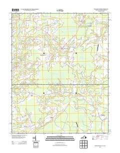
2013 Map of Whaleyville
USGS Topo · Published 2013About this map
Whaleyville stands at the heart of this agricultural and wetland landscape straddling the Virginia-North Carolina border. The area is defined by an intricate network of waterways, including the winding Dragon Swamp and Duke Swamp, which have long dictated the placement of roads and small communities. These wetlands are interspersed with crossroads settlements like Wiggins Crossroads and Somerton, where rural life is centered around local junctions and farm estates.
Find a feature on this map
53 named features on this map. Tap any name to fly to it.
Don’t see what you’re looking for? This feature index may not catch every label — zoom into the map to look around manually.
Map Details
Editions of this 2013 Whaleyville Map
This is the sole edition of this map. No revisions or reprints were ever made.
Other maps of this area

1906 · Beckford
USGS Topo · 1:48,000

1907 · Beckford
USGS Topo · 1:62,500

1908 · Winton
USGS Topo · 1:62,500

1919 · Suffolk
USGS Topo · 1:62,500

1920 · Holland
USGS Topo · 1:62,500

1940 · Beckford
USGS Topo · 1:62,500

1943 · Holland
USGS Topo · 1:62,500

1953 · Norfolk
USGS Topo · 1:250,000
1954 · Buckhorn
USGS Topo · 1:24,000

1954 · Corapeake
USGS Topo · 1:24,000