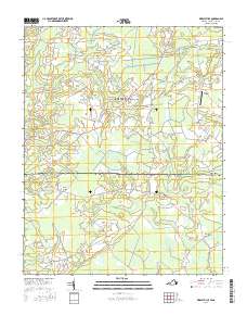
2016 Map of Whaleyville
USGS Topo · Published 2016About this map
Whaleyville and the surrounding borderlands of Suffolk and Gates County reveal a landscape deeply defined by the transition from Virginia's Tidewater into North Carolina's coastal plains. This region is characterized by extensive wetlands, including the Black Mingle Pocosin and Hall Pocosin, which have historically shaped the settlement patterns and road networks like Whaleyville Blvd. Small, rural communities such as Willeyton, Hazelton, and Drum Hill are connected by a web of local roads, while an Old Rail Bed serves as a tangible reminder of former timber or agricultural transit lines that once linked these isolated outposts.
Find a feature on this map
65 named features on this map. Tap any name to fly to it.
Don’t see what you’re looking for? This feature index may not catch every label — zoom into the map to look around manually.
Map Details
Editions of this 2016 Whaleyville Map
This is the sole edition of this map. No revisions or reprints were ever made.
Other maps of this area

1906 · Beckford
USGS Topo · 1:48,000

1907 · Beckford
USGS Topo · 1:62,500

1908 · Winton
USGS Topo · 1:62,500

1919 · Suffolk
USGS Topo · 1:62,500

1920 · Holland
USGS Topo · 1:62,500

1940 · Beckford
USGS Topo · 1:62,500

1943 · Holland
USGS Topo · 1:62,500

1953 · Norfolk
USGS Topo · 1:250,000
1954 · Buckhorn
USGS Topo · 1:24,000

1954 · Corapeake
USGS Topo · 1:24,000