2023 Map of Wharton
USGS Topo · Published 2023About this map
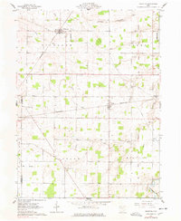
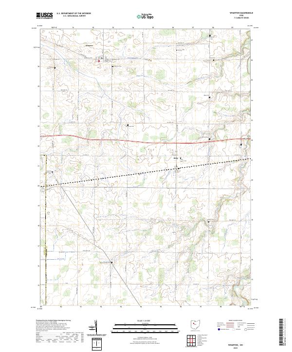
Wharton and Kirby serve as the primary anchors for this agricultural portion of Wyandot County, where the landscape is defined by an intricate network of waterways and drainage improvements. Numerous family-named cemeteries, including Spoon Cem, Inman Cem, and Callahan Cem, are scattered throughout the townships, providing a clear geographic record of early settler families. The drainage of the land is carefully documented through features like Blake Ditch and the winding course of Potato Run, reflecting the area's conversion from original wetlands to productive farmland. In the south, the terrain follows Tymochtee Creek and The Outlet, while the surveyor's grid is preserved in the section lines of t2s r12e and t3s r13e. This map captures the intersection of rural infrastructure and genealogical history, from the local Po in Wharton to the Jackson Center Cem near the southern border.
Find a feature on this map
52 named features on this map. Tap any name to fly to it.
Don’t see what you’re looking for? This feature index may not catch every label — zoom into the map to look around manually.
Map Details
Editions of this 2023 Wharton Map
This is the sole edition of this map. No revisions or reprints were ever made.