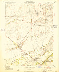
1949 Map of Wheatland
USGS Topo · Published 1949About this map
Wheatland anchors the southern portion of this landscape at the intersection of the Southern Pacific railroad and the Bear River. This 1940s survey reveals a region defined by large agricultural holdings and water management, notably the historic Johnson Rancho and extensive Levee systems designed to control Dry Creek and Grasshopper Slough. The northern section of the map is dominated by the Camp Beale Military Reservation, showing the geometric grid of the base just years after its establishment during World War II.
Find a feature on this map
22 named features on this map. Tap any name to fly to it.
Don’t see what you’re looking for? This feature index may not catch every label — zoom into the map to look around manually.
Map Details
Editions of this 1949 Wheatland Map
This is the sole edition of this map. No revisions or reprints were ever made.
Other maps of this area

1888 · Marysville
USGS Topo · 1:125,000

1888 · Smartsville
USGS Topo · 1:125,000

1891 · Sacramento
USGS Topo · 1:125,000

1891 · Marysville
USGS Topo · 1:125,000

1891 · Smartsville
USGS Topo · 1:125,000

1892 · Sacramento
USGS Topo · 1:125,000

1892 · Smartsville
USGS Topo · 1:125,000

1893 · Sacramento
USGS Topo · 1:125,000

1894 · Smartsville
USGS Topo · 1:125,000

1894 · Marysville
USGS Topo · 1:125,000