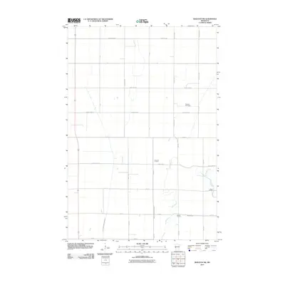
2010 Map of Wheaton NW
USGS Topo · Published 2010About this map
Immanuel Cemetery and Sharon Cemetery anchor the rural landscape of Traverse County in this 2010 USGS study. The terrain is defined by a strictly organized grid of agricultural roads and an extensive network of water management features, including County Drain Number Twentyseven and County Ditch Number Thirtysix. These man-made channels support the intensive farming of the Red River Valley, cutting through the prairie to manage the heavy spring runoff typical of the region.
Find a feature on this map
28 named features on this map. Tap any name to fly to it.
Don’t see what you’re looking for? This feature index may not catch every label — zoom into the map to look around manually.
Map Details
Editions of this 2010 Wheaton NW Map
This is the sole edition of this map. No revisions or reprints were ever made.
Other maps of this area

1904 · Wahpeton
USGS Topo · 1:125,000

1915 · White Rock
USGS Topo · 1:62,500

1918 · White Rock
USGS Topo · 1:62,500

1951 · Wheaton
USGS Topo · 1:62,500

1951 · Campbell
USGS Topo · 1:62,500

1953 · Milbank
USGS Topo · 1:250,000

1953 · Fargo
USGS Topo · 1:250,000

1956 · Fargo
USGS Topo · 1:250,000

1958 · Milbank
USGS Topo · 1:250,000
1972 · Boisberg
USGS Topo · 1:24,000