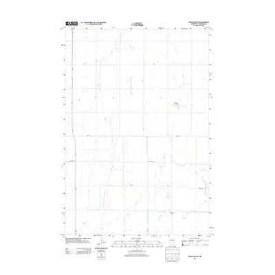
2013 Map of Wheaton NW
USGS Topo · Published 2013About this map
Agricultural lands in Traverse County are defined by an extensive water management system that includes County Drain Number Twentyseven and County Drain Number Thirtysix. The landscape is dominated by the Mustinka River, which shows a complex hydrological history through its preserved Old Channel loops. This rural area is anchored by several small burial sites that serve as primary markers for local genealogy, including Immanuel Cem, Sharon Cem, and Monson Cem. Transport is facilitated by Us-75, running north-south through the western portion of the map, and the Traverse Air Airport positioned near the eastern boundary. The grid-like arrangement of roads like 640th St and 720th St illustrates the deliberate organization of Minnesota's prairie farmland during the early 21st century.
Find a feature on this map
18 named features on this map. Tap any name to fly to it.
Don’t see what you’re looking for? This feature index may not catch every label — zoom into the map to look around manually.
Map Details
Editions of this 2013 Wheaton NW Map
This is the sole edition of this map. No revisions or reprints were ever made.
Other maps of this area

1904 · Wahpeton
USGS Topo · 1:125,000

1915 · White Rock
USGS Topo · 1:62,500

1918 · White Rock
USGS Topo · 1:62,500

1951 · Wheaton
USGS Topo · 1:62,500

1951 · Campbell
USGS Topo · 1:62,500

1953 · Milbank
USGS Topo · 1:250,000

1953 · Fargo
USGS Topo · 1:250,000

1956 · Fargo
USGS Topo · 1:250,000

1958 · Milbank
USGS Topo · 1:250,000
1972 · Boisberg
USGS Topo · 1:24,000