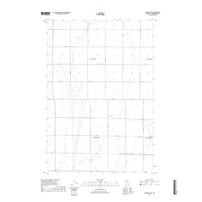
2019 Map of Wheaton NW
USGS Topo · Published 2019About this map
The agricultural landscape of Traverse County unfolds along the Mustinka River in this modern topographic study. The terrain is defined by a sophisticated system of water management, visible through engineered features like County Ditch Number Thirtysix and County Drain Number Thirtyseven, which cut across the flat prairie lands. These waterways, alongside the Fivemile Creek and various segments of the Old Channel, trace the drainage patterns vital to the region's farming economy.
Find a feature on this map
31 named features on this map. Tap any name to fly to it.
Don’t see what you’re looking for? This feature index may not catch every label — zoom into the map to look around manually.
Map Details
Editions of this 2019 Wheaton NW Map
This is the sole edition of this map. No revisions or reprints were ever made.
Other maps of this area

1904 · Wahpeton
USGS Topo · 1:125,000

1915 · White Rock
USGS Topo · 1:62,500

1918 · White Rock
USGS Topo · 1:62,500

1951 · Wheaton
USGS Topo · 1:62,500

1951 · Campbell
USGS Topo · 1:62,500

1953 · Milbank
USGS Topo · 1:250,000

1953 · Fargo
USGS Topo · 1:250,000

1956 · Fargo
USGS Topo · 1:250,000

1958 · Milbank
USGS Topo · 1:250,000
1972 · Boisberg
USGS Topo · 1:24,000