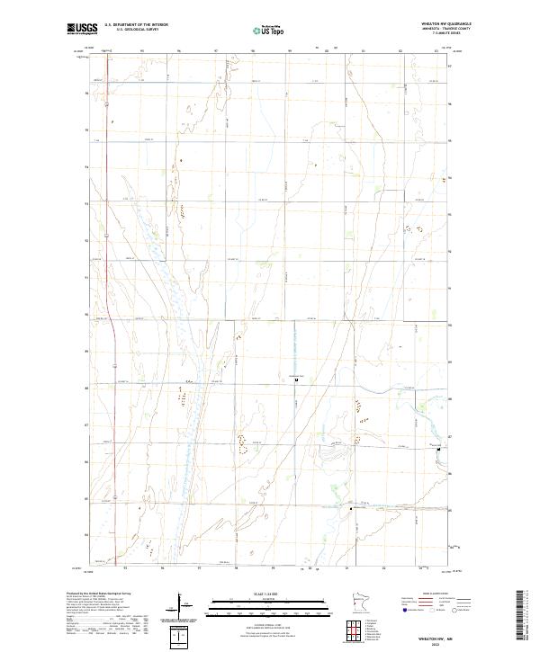
2022 Map of Wheaton NW
USGS Topo · Published 2022About this map
The Mustinka River meanders across the lower portion of this Traverse County landscape, leaving behind the traces of an Old Channel as the waterway was managed for agricultural drainage. This prairie region is defined by an extensive network of engineered waterways, including County Ditch Number Thirty-six and County Drain Number Twenty-seven, which crisscross the grid of section lines and county roads. For those tracing family roots in this part of Minnesota, the map identifies three key burial sites that anchor the rural community: Monson Cem, Immanuel Cem, and Sharon Cem. These sites, along with the proximity of Fivemile Cr, provide essential landmarks for understanding the early 21st-century settlement patterns and land use in this fertile agricultural corner of the state.
Find a feature on this map
45 named features on this map. Tap any name to fly to it.
Don’t see what you’re looking for? This feature index may not catch every label — zoom into the map to look around manually.
Map Details
Editions of this 2022 Wheaton NW Map
This is the sole edition of this map. No revisions or reprints were ever made.
Other maps of this area

1904 · Wahpeton
USGS Topo · 1:125,000

1915 · White Rock
USGS Topo · 1:62,500

1918 · White Rock
USGS Topo · 1:62,500

1951 · Wheaton
USGS Topo · 1:62,500

1951 · Campbell
USGS Topo · 1:62,500

1953 · Milbank
USGS Topo · 1:250,000

1953 · Fargo
USGS Topo · 1:250,000

1956 · Fargo
USGS Topo · 1:250,000

1958 · Milbank
USGS Topo · 1:250,000
1972 · Boisberg
USGS Topo · 1:24,000