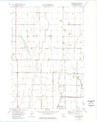
1974 Map of Wheaton NW
USGS Topo · Published 1976About this map
Taylor and Monson townships define this agricultural landscape in the mid-1970s, where the management of water is the primary geographic feature. The terrain is crisscrossed by an extensive network of man-made waterways, including Judicial Ditch No 11, County Ditch No 13, and the Mustinka River Ditch, reflecting the drainage efforts required to sustain prairie farming. The Mustinka River itself shows an interesting hydrological history, with an Old Channel bypassed by a more direct Channel route.
Find a feature on this map
25 named features on this map. Tap any name to fly to it.
Don’t see what you’re looking for? This feature index may not catch every label — zoom into the map to look around manually.
Map Details
Editions of this 1974 Wheaton NW Map
This is the sole edition of this map. No revisions or reprints were ever made.
Other maps of this area

1904 · Wahpeton
USGS Topo · 1:125,000

1915 · White Rock
USGS Topo · 1:62,500

1918 · White Rock
USGS Topo · 1:62,500

1951 · Wheaton
USGS Topo · 1:62,500

1951 · Campbell
USGS Topo · 1:62,500

1953 · Milbank
USGS Topo · 1:250,000

1953 · Fargo
USGS Topo · 1:250,000

1956 · Fargo
USGS Topo · 1:250,000

1958 · Milbank
USGS Topo · 1:250,000
1972 · Boisberg
USGS Topo · 1:24,000