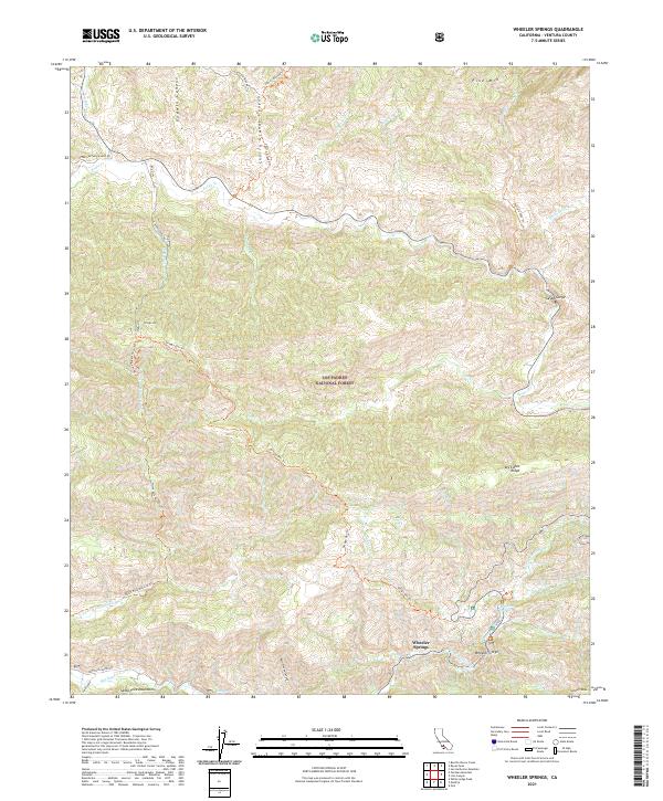
2021 Map of Wheeler Springs
USGS Topo · Published 2021About this map
The Los Padres National Forest anchors this high-elevation survey of Ventura County, dominated by the drainage systems of Sespe Cr and Matilija Cr. The small community of Wheeler Springs sits at a critical junction near the Wheeler Gorge, where the topography transitions into the steep slopes of the Santa Ynez Mountains. The map reveals a landscape defined by seasonal water and recreational access, featuring numerous canyons like Godwin Canyon and Rattlesnake Canyon alongside high points such as Pine Mtn. Modern access for land management and exploration is evidenced by the network of tracks including Gypsum Mine Rd, Matilija Canyon Rd, and the Ortega Ohv Trl. Notable localized features such as Bellyache Springs and a Hot Spring near the canyon floor provide specific points of interest for historical geographers and researchers tracing the region's development as a backcountry destination.
Find a feature on this map
41 named features on this map. Tap any name to fly to it.
Don’t see what you’re looking for? This feature index may not catch every label — zoom into the map to look around manually.
Map Details
Editions of this 2021 Wheeler Springs Map
This is the sole edition of this map. No revisions or reprints were ever made.
Other maps of this area

1903 · Santa Paula
USGS Topo · 1:62,500

1903 · Mt. Pinos
USGS Topo · 1:125,000

1904 · Ventura
USGS Topo · 1:62,500

1941 · Ventura
USGS Topo · 1:62,500

1942 · Santa Paula
USGS Topo · 1:62,500

1942 · Wheeler Springs
USGS Topo · 1:24,000

1943 · Rancho Nuevo Creek
USGS Topo · 1:24,000

1943 · Old Man Mountain
USGS Topo · 1:24,000

1943 · San Guillermo
USGS Topo · 1:24,000

1943 · Lion Canyon
USGS Topo · 1:24,000