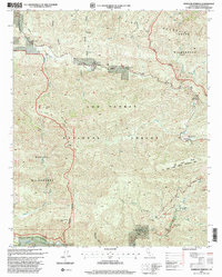
1995 Map of Wheeler Springs
USGS Topo · Published 2000About this map
Wheeler Springs serves as a focal point for this 1995 revision of the Ventura County mountains, where the drainage networks of Sespe Creek and Matilija Creek define the landscape. This era of management within the Los Padres National Forest shows a transition toward preservation and recreation, marked by the extensive Sespe Wilderness and Matilija Wilderness boundaries. Local history is reflected in the remaining ranch sites like Felt Ranch and the Faser Cold Springs Ranch, alongside early infrastructure such as the Gaging Station at Sespe Gorge. The presence of the Matilija Falls Nature Trail and the Dry Lakes Ridge Botanical Area highlights the scientific and public interest in the region's diverse ecosystems during the late twentieth century.
Find a feature on this map
31 named features on this map. Tap any name to fly to it.
Don’t see what you’re looking for? This feature index may not catch every label — zoom into the map to look around manually.
Map Details
Editions of this 1995 Wheeler Springs Map
This is the sole edition of this map. No revisions or reprints were ever made.
Other maps of this area

1903 · Santa Paula
USGS Topo · 1:62,500

1903 · Mt. Pinos
USGS Topo · 1:125,000

1904 · Ventura
USGS Topo · 1:62,500

1941 · Ventura
USGS Topo · 1:62,500

1942 · Santa Paula
USGS Topo · 1:62,500

1942 · Wheeler Springs
USGS Topo · 1:24,000

1943 · Rancho Nuevo Creek
USGS Topo · 1:24,000

1943 · Old Man Mountain
USGS Topo · 1:24,000

1943 · San Guillermo
USGS Topo · 1:24,000

1943 · Lion Canyon
USGS Topo · 1:24,000