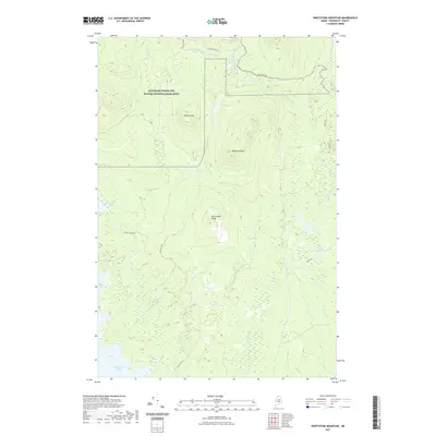
2021 Map of Whetstone Mountain
USGS Topo · Published 2021About this map
Katahdin Woods and Waters National Monument dominates the northwestern portion of this northern Maine landscape, protecting a vast expanse of timberland and watersheds. The terrain is defined by significant elevations like Whetstone Mtn, Kelloch Mtn, and the long spine of Millinocket Ridge. Below these heights, a complex network of waterways feeds into larger bodies, including Millinocket Lake at the southwestern edge and the Mud Brook Flowage.
Find a feature on this map
25 named features on this map. Tap any name to fly to it.
Don’t see what you’re looking for? This feature index may not catch every label — zoom into the map to look around manually.
Map Details
Editions of this 2021 Whetstone Mountain Map
This is the sole edition of this map. No revisions or reprints were ever made.
Other maps of this area

1927 · Katahdin
USGS Topo · 1:48,000

1930 · Katahdin
USGS Topo · 1:62,500

1949 · Katahdin
USGS Topo · 1:62,500

1951 · Norcross
USGS Topo · 1:62,500

1951 · Millinocket
USGS Topo · 1:62,500

1953 · Stacyville
USGS Topo · 1:62,500

1954 · Millinocket
USGS Topo · 1:250,000

1958 · Millinocket
USGS Topo · 1:250,000

1960 · Millinocket
USGS Topo · 1:250,000
1975 · Stacyville NW
USGS Topo · 1:24,000