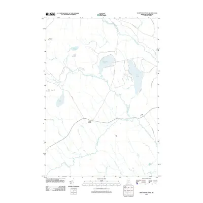
2011 Map of Whetstone Pond
USGS Topo · Published 2011About this map
Whetstone Pond and Piper Pond anchor this landscape of the Maine woods, where small settlements and seasonal roads intersect a complex network of waterways. Small communities like Happy Corner and Cole Corner are positioned along the primary transit corridors, reflecting a settlement pattern tied to the topography of the central Highlands. The Piscataquis River flows through the northern reaches of the quadrangle, joined by numerous tributaries such as Thorn Brook and Kingsbury Stream.
Find a feature on this map
43 named features on this map. Tap any name to fly to it.
Don’t see what you’re looking for? This feature index may not catch every label — zoom into the map to look around manually.
Map Details
Editions of this 2011 Whetstone Pond Map
This is the sole edition of this map. No revisions or reprints were ever made.
Other maps of this area

1933 · Guilford
USGS Topo · 1:62,500

1937 · Guilford
USGS Topo · 1:62,500

1948 · Kingsbury
USGS Topo · 1:62,500

1950 · Kingsbury
USGS Topo · 1:62,500

1950 · Sebec Lake
USGS Topo · 1:62,500

1951 · Greenville
USGS Topo · 1:62,500

1954 · Millinocket
USGS Topo · 1:250,000

1958 · Millinocket
USGS Topo · 1:250,000

1960 · Millinocket
USGS Topo · 1:250,000

1975 · Kingsbury NE
USGS Topo · 1:24,000