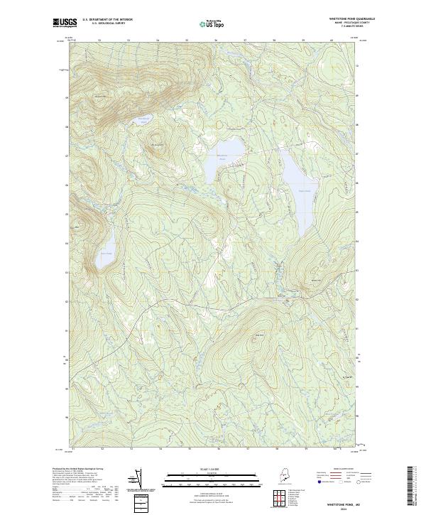
2024 Map of Whetstone Pond
USGS Topo · Published 2024About this map
The Piscataquis River cuts through the northern reaches of this landscape, marking a terrain defined by significant elevation changes and numerous isolated water bodies. High points like Russell Mtn and Little Russell Mtn overlook Punchbowl Pond, while the southern expanse transitions into lower marshlands and drainages such as Cook Bog and Mud Pond. The distribution of timber roads and specialized lanes, including Coles Corner Rd and Happy Corner Rd, suggests a region largely dedicated to forest management and seasonal recreation.
Find a feature on this map
49 named features on this map. Tap any name to fly to it.
Don’t see what you’re looking for? This feature index may not catch every label — zoom into the map to look around manually.
Map Details
Editions of this 2024 Whetstone Pond Map
This is the sole edition of this map. No revisions or reprints were ever made.
Other maps of this area

1933 · Guilford
USGS Topo · 1:62,500

1937 · Guilford
USGS Topo · 1:62,500

1948 · Kingsbury
USGS Topo · 1:62,500

1950 · Kingsbury
USGS Topo · 1:62,500

1950 · Sebec Lake
USGS Topo · 1:62,500

1951 · Greenville
USGS Topo · 1:62,500

1954 · Millinocket
USGS Topo · 1:250,000

1958 · Millinocket
USGS Topo · 1:250,000

1960 · Millinocket
USGS Topo · 1:250,000

1975 · Kingsbury NE
USGS Topo · 1:24,000