2022 Map of Whippoorwill
USGS Topo · Published 2022About this map
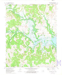
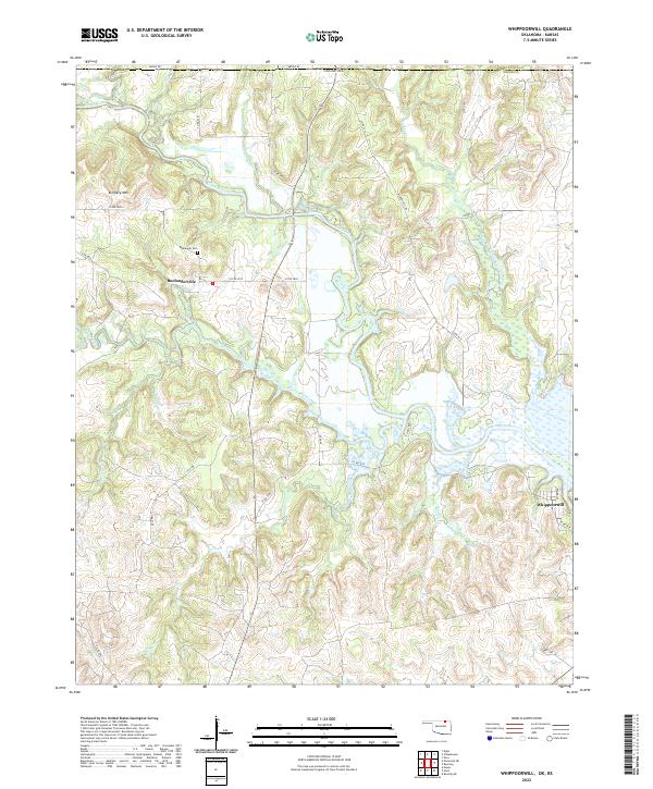
Boulangerville and its namesake Boulanger Cem serve as focal points for this survey of the Osage County landscape near the Kansas border. The Caney River winds through the northern portion of the terrain, while the southern reaches are defined by a network of drainage systems including Birch Creek, Turkey Creek, and Coon Creek. The presence of Artillery Mtn provides a distinct topographical landmark overlooking the river valley. Local transportation is represented by a grid of rural routes such as Hickory Hill Rd and Arrow Rd, which connect the small settlement of Whippoorwill to the surrounding ranching and agricultural lands. The map illustrates the contemporary intersection of natural waterways and modern land management, where seasonal wetlands and features like Silo Cove punctuate the Osage hills.
Find a feature on this map
38 named features on this map. Tap any name to fly to it.
Don’t see what you’re looking for? This feature index may not catch every label — zoom into the map to look around manually.
Map Details
Editions of this 2022 Whippoorwill Map
This is the sole edition of this map. No revisions or reprints were ever made.