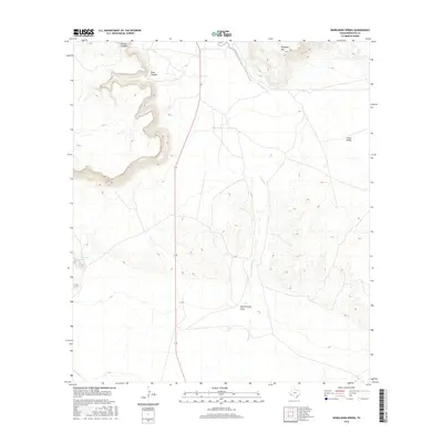
2016 Map of Whirlwind Spring
USGS Topo · Published 2016About this map
Whirlwind Spring serves as a critical water source in this arid stretch of Brewster County, where the desert landscape is defined by dramatic elevation shifts and seasonal drainages. Rising in the northern part of the quadrangle, Elephant Mtn dominates the skyline, while deep cuts like Torvea Canyon and Bear Canyon mark the western high ground. The drainage network is anchored by Calamity Creek, which flows southward through the center of the sheet toward Butcherknife Draw. This modern survey by the U.S. Geological Survey shows how the terrain dictates the path of Route 118, the primary artery cutting through the valley between the high canyons and the eastern expanse of Chalk Valley. The map captures a landscape where water features, though sparse, define the historical and contemporary utility of the land.
Find a feature on this map
9 named features on this map. Tap any name to fly to it.
Don’t see what you’re looking for? This feature index may not catch every label — zoom into the map to look around manually.
Map Details
Editions of this 2016 Whirlwind Spring Map
This is the sole edition of this map. No revisions or reprints were ever made.
Other maps of this area

1895 · Alpine
USGS Topo · 1:125,000

1917 · Santiago Peak
USGS Topo · 1:62,500

1917 · Buck Hill
USGS Topo · 1:62,500

1918 · Bone Spring
USGS Topo · 1:125,000

1918 · Buck Hill
USGS Topo · 1:62,500

1918 · Santiago Peak
USGS Topo · 1:62,500

1920 · Monument Spring
USGS Topo · 1:62,500

1921 · Monument Spring
USGS Topo · 1:62,500

1925 · Buck Hill
USGS Topo · 1:62,500
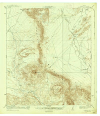
1938 · Santiago Peak
USGS Topo · 1:62,500