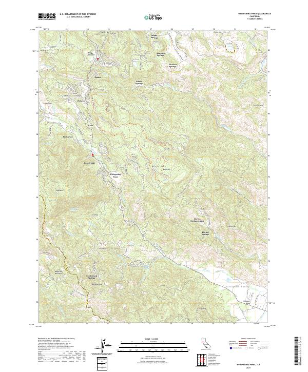
2021 Map of Whispering Pines
USGS Topo · Published 2021About this map
Harbin Springs and Anderson Springs anchor this portion of the Mayacmas Mountains, where the landscape is defined by its numerous mineral springs and mountain retreats. The map reveals a dense network of small communities including Hobergs, Whispering Pines, and Loch Lomond, many established around the geological features of the Lake and Sonoma county line. The prominence of Boggs Mountain State Forest and the nearby Cobb Mtn illustrate a region characterized by high-elevation settlements and resource management. Grounded in the rugged geography of the volcanic field, the transition from the valley floor at Collayomi Valley to the heights of Seigler Mtn highlights the area's historical reliance on seasonal tourism and geothermal activity. Tracing the drainages of Putah Cr and Big Canyon Cr, one can see how roads like Co Rd 107 follow the natural contours to connect these remote mountain outposts.
Find a feature on this map
140 named features on this map. Tap any name to fly to it.
Don’t see what you’re looking for? This feature index may not catch every label — zoom into the map to look around manually.
Map Details
Editions of this 2021 Whispering Pines Map
This is the sole edition of this map. No revisions or reprints were ever made.
Other maps of this area

1920 · Healdsburg
USGS Topo · 1:62,500

1921 · Kelseyville
USGS Topo · 1:62,500

1927 · Calistoga
USGS Topo · 1:62,500

1933 · Healdsburg
USGS Topo · 1:48,000

1940 · Healdsburg
USGS Topo · 1:62,500

1943 · Calistoga
USGS Topo · 1:62,500

1943 · Kelseyville
USGS Topo · 1:62,500

1945 · Calistoga
USGS Topo · 1:62,500

1945 · Lower Lake
USGS Topo · 1:62,500

1947 · Santa Rosa
USGS Topo · 1:250,000