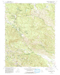
1993 Map of Whispering Pines
USGS Topo · Published 1993About this map
The geothermal and resort landscapes of southern Lake County are defined by a high concentration of mineral springs and active energy production. Whispering Pines and Anderson Springs occupy a terrain shaped by volcanic activity, where numerous Geothermal Wells dot the slopes near the Lake Co Sonoma Co line. This 1993 revision details the intersection of early twentieth-century resort culture and modern resource extraction, noting several historic spring locations including Harbin Springs, Howard Springs, and Ettawa Springs.
Find a feature on this map
50 named features on this map. Tap any name to fly to it.
Don’t see what you’re looking for? This feature index may not catch every label — zoom into the map to look around manually.
Map Details
Editions of this 1993 Whispering Pines Map
This is the sole edition of this map. No revisions or reprints were ever made.
Other maps of this area

1920 · Healdsburg
USGS Topo · 1:62,500

1921 · Kelseyville
USGS Topo · 1:62,500

1927 · Calistoga
USGS Topo · 1:62,500

1933 · Healdsburg
USGS Topo · 1:48,000

1940 · Healdsburg
USGS Topo · 1:62,500

1943 · Calistoga
USGS Topo · 1:62,500

1943 · Kelseyville
USGS Topo · 1:62,500

1945 · Calistoga
USGS Topo · 1:62,500

1945 · Lower Lake
USGS Topo · 1:62,500

1947 · Santa Rosa
USGS Topo · 1:250,000