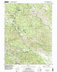
1998 Map of Whispering Pines
USGS Topo · Published 2002About this map
Boggs Mountain State Forest dominates the central terrain of this Lake County landscape, where the geography is defined by its thermal activity and mountain retreats. The late-twentieth-century landscape reveals a specialized industrial and recreational economy, evidenced by the numerous Geothermal Wells and a Power Plant concentrated near Anderson Springs. These industrial sites contrast with the established network of mountain resorts and small communities like Whispering Pines, Loch Lomond, and Hobergs.
Find a feature on this map
55 named features on this map. Tap any name to fly to it.
Don’t see what you’re looking for? This feature index may not catch every label — zoom into the map to look around manually.
Map Details
Editions of this 1998 Whispering Pines Map
This is the sole edition of this map. No revisions or reprints were ever made.
Other maps of this area

1920 · Healdsburg
USGS Topo · 1:62,500

1921 · Kelseyville
USGS Topo · 1:62,500

1927 · Calistoga
USGS Topo · 1:62,500

1933 · Healdsburg
USGS Topo · 1:48,000

1940 · Healdsburg
USGS Topo · 1:62,500

1943 · Calistoga
USGS Topo · 1:62,500

1943 · Kelseyville
USGS Topo · 1:62,500

1945 · Calistoga
USGS Topo · 1:62,500

1945 · Lower Lake
USGS Topo · 1:62,500

1947 · Santa Rosa
USGS Topo · 1:250,000