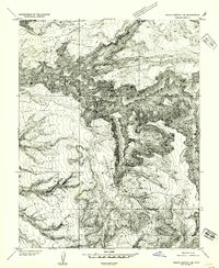
1954 Map of White Canyon 1 SE
USGS Topo · Published 1954About this map
Dark Canyon dominates this 1952 topographic study of the canyonlands in San Juan County, showing a landscape defined by dramatic elevation changes and erosion. The intricate drainage network is anchored by Woodens Shoe Canyon and Lost Canyon, which cut through the high plateaus of Black Point. The map captures the area just before the major push for uranium exploration in the region, documenting a period when human impact was limited to small water catchments like the Reservoir and the seasonal cattle range across Upper Horse Flats and Lower Horse Flats. Other significant drainages like Gravel Canyon and Black Seep Canyon reveal the complex topography of this high-desert environment before modern access roads were established.
Find a feature on this map
12 named features on this map. Tap any name to fly to it.
Don’t see what you’re looking for? This feature index may not catch every label — zoom into the map to look around manually.
Map Details
Editions of this 1954 White Canyon 1 SE Map
This is the sole edition of this map. No revisions or reprints were ever made.
Other maps of this area

1886 · Henry Mountains
USGS Topo · 1:250,000

1886 · Abajo
USGS Topo · 1:250,000

1892 · Abajo
USGS Topo · 1:250,000

1892 · Henry Mountains
USGS Topo · 1:250,000

1893 · Abajo
USGS Topo · 1:250,000

1935 · Elk Ridge
USGS Topo · 1:96,000

1940 · Elk Ridge
USGS Topo · 1:125,000

1952 · Mouth of Dark Canyon
USGS Topo · 1:62,500

1952 · Natural Bridges
USGS Topo · 1:62,500
1954 · White Canyon 1 NE
USGS Topo · 1:24,000