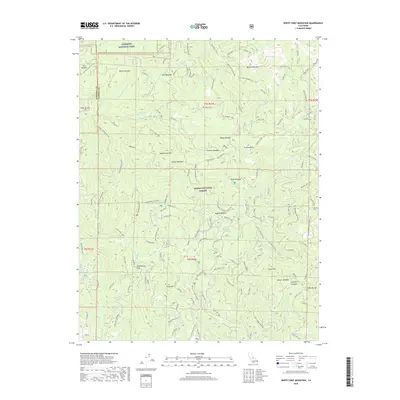
2018 Map of White Chief Mountain
USGS Topo · Published 2018About this map
Yosemite National Park and the Sierra National Forest meet in this high-altitude landscape dominated by granite peaks and ancient groves. The map reveals a complex network of forest service roads and trails, such as Beasore Road and the Goat Meadow Upper Ski Trail, providing access to landmark summits like White Chief Mountain and Fresno Dome. Notable natural sites such as the Shadow of Giants and the Graveyard of Giants suggest the presence of massive sequoias or significant timber stands that have long defined the character of this region.
Find a feature on this map
92 named features on this map. Tap any name to fly to it.
Don’t see what you’re looking for? This feature index may not catch every label — zoom into the map to look around manually.
Map Details
Editions of this 2018 White Chief Mountain Map
This is the sole edition of this map. No revisions or reprints were ever made.
Other maps of this area

1897 · Yosemite
USGS Topo · 1:125,000

1900 · Yosemite
USGS Topo · 1:125,000

1901 · Mt. Lyell
USGS Topo · 1:125,000

1903 · Yosemite
USGS Topo · 1:125,000

1904 · Kaiser
USGS Topo · 1:125,000

1909 · Yosemite
USGS Topo · 1:125,000

1912 · Mariposa
USGS Topo · 1:125,000

1947 · Mariposa
USGS Topo · 1:250,000

1948 · Mariposa
USGS Topo · 1:250,000

1953 · Merced Peak
USGS Topo · 1:62,500