
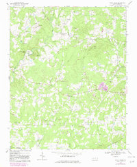
1968 Map of White Cross
USGS Topo · Published 1969About this map
The rural communities of western Orange County are documented here during the late 1960s, a landscape defined by small crossroads settlements and numerous country congregations. Small-scale development is centered at White Cross and Dodsons Crossroads, while agricultural and timbered lands are broken by prominent topographical features such as Thompson Mtn and Pickards Mtn. The survey provides excellent genealogical detail through its mapping of local worship centers, including Cane Creek Ch, Antioch Ch, and the Orange Chapel.
Find a feature on this map
40 named features on this map. Tap any name to fly to it.
Don’t see what you’re looking for? This feature index may not catch every label — zoom into the map to look around manually.
Map Details
Editions of this 1968 White Cross Map
2 editions found
Other maps of this area

1946 · Chapel Hill
USGS Topo · 1:24,000

1947 · Chapel Hill
USGS Topo · 1:31,680

1951 · Farrington
USGS Topo · 1:24,000

1953 · Raleigh
USGS Topo · 1:250,000

1953 · Greensboro
USGS Topo · 1:250,000

1954 · Greensboro
USGS Topo · 1:250,000

1954 · Raleigh
USGS Topo · 1:250,000

1962 · Greensboro
USGS Topo · 1:250,000

1966 · Greensboro
USGS Topo · 1:250,000

1968 · Efland
USGS Topo · 1:24,000