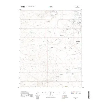
2020 Map of White Hills
USGS Topo · Published 2020About this map
Santa Clara and the western outskirts of St. George anchor this landscape where the Santa Clara River joins the Virgin River. The terrain is defined by dramatic topographic transitions, from the White Hills and South Hills to the shifting sands of the Mojave Desert. Notable landforms such as Starvation Point, Red Bluff, and Boomer Hill overlook a network of modern recreation trails like the Bearclaw Poppy and Bloomington Microloop Ride. In the southern reaches, the historical site of Atkinville sits near the Atkinville Wash and Curly Hollow Wash, reflecting the early settlement patterns along the river valley. The map reveals how local hydrology is managed through features like the Curley Hollow Reservoir and multiple Stucki Springs, which serve this arid region at the edge of the Great Basin and Colorado Plateau.
Find a feature on this map
61 named features on this map. Tap any name to fly to it.
Don’t see what you’re looking for? This feature index may not catch every label — zoom into the map to look around manually.
Map Details
Editions of this 2020 White Hills Map
This is the sole edition of this map. No revisions or reprints were ever made.
Other maps of this area

1885 · St. George
USGS Topo · 1:250,000

1886 · Mt. Trumbull
USGS Topo · 1:250,000

1891 · St. George
USGS Topo · 1:250,000

1892 · Mt. Trumbull
USGS Topo · 1:250,000

1953 · Cedar City
USGS Topo · 1:250,000

1953 · Grand Canyon
USGS Topo · 1:250,000

1954 · Beaver Dam Mts NE
USGS Topo · 1:24,000

1954 · Wolf Hole Mtn. NW
USGS Topo · 1:24,000

1954 · Beaver Dam Mts SE
USGS Topo · 1:24,000

1954 · Wolf Hole Mtn. NE
USGS Topo · 1:24,000