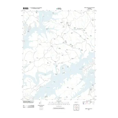
2010 Map of White Hollow
USGS Topo · Published 2010About this map
The complex shoreline of the Powell River and Big Ridge Lake defines this portion of Campbell County, where the topography is a dense network of ridges and hollows. Family history is etched into the landscape through dozens of burial grounds, including the Lays Cemetery, Blue Springs Cemetery, and the Longmire Cemetery. The map captures a transition between recreation and resource extraction, featuring the Tanasi Council Girl Scout Camp and the Hickory Star Boat Dock alongside industrial sites like the Newton Hill Quarry and the Wilson Prospect.
Find a feature on this map
96 named features on this map. Tap any name to fly to it.
Don’t see what you’re looking for? This feature index may not catch every label — zoom into the map to look around manually.
Map Details
Editions of this 2010 White Hollow Map
This is the sole edition of this map. No revisions or reprints were ever made.
Other maps of this area

1893 · Briceville
USGS Topo · 1:125,000

1895 · Briceville
USGS Topo · 1:125,000

1896 · Briceville
USGS Topo · 1:125,000

1897 · Maynardville
USGS Topo · 1:125,000

1900 · Maynardville
USGS Topo · 1:125,000

1935 · Graveston
USGS Topo · 1:24,000

1935 · Well Spring
USGS Topo · 1:24,000

1936 · Gorryton
USGS Topo · 1:48,000

1936 · Ausmus
USGS Topo · 1:24,000

1936 · White Hollow
USGS Topo · 1:24,000