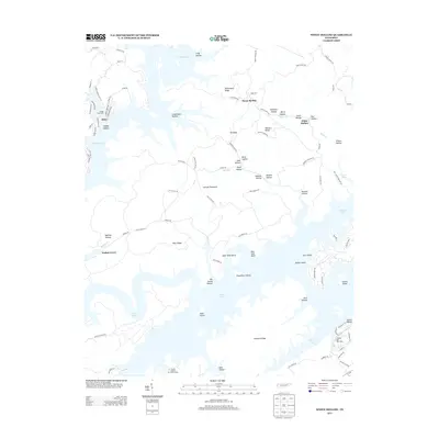
2013 Map of White Hollow
USGS Topo · Published 2013About this map
Lake Norris and the winding reaches of Norris Lake define the geography of this Tennessee landscape, where the inundated valleys of the Clinch River system create a complex network of peninsulas and islands. The terrain is marked by a series of deep hollows, many bearing family names like Lindamood Hollow, Lamb Hollow, and Roe Hollow, which reflect the early settlement patterns and genealogy of the region. Williamson Ridge and Pinnacle Ridge rise above the water, providing the high ground that survived the valley's flooding. Small lakeside communities and recreational hubs such as Alder and Walnut Grove are nestled along the shoreline, alongside essential local landmarks like the Springs Boat Dock and Hickory Star Boat Dock. The presence of the Tanasi Council Girl Scout Camp and several named islands, including Wood Duck Island and Gourd Island, highlights the area's transition into a prominent regional destination for outdoor life.
Find a feature on this map
96 named features on this map. Tap any name to fly to it.
Don’t see what you’re looking for? This feature index may not catch every label — zoom into the map to look around manually.
Map Details
Editions of this 2013 White Hollow Map
This is the sole edition of this map. No revisions or reprints were ever made.
Other maps of this area

1893 · Briceville
USGS Topo · 1:125,000

1895 · Briceville
USGS Topo · 1:125,000

1896 · Briceville
USGS Topo · 1:125,000

1897 · Maynardville
USGS Topo · 1:125,000

1900 · Maynardville
USGS Topo · 1:125,000

1935 · Graveston
USGS Topo · 1:24,000

1935 · Well Spring
USGS Topo · 1:24,000

1936 · Gorryton
USGS Topo · 1:48,000

1936 · Ausmus
USGS Topo · 1:24,000

1936 · White Hollow
USGS Topo · 1:24,000