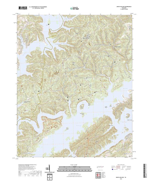
2022 Map of White Hollow
USGS Topo · Published 2022About this map
Norris Lake dominates the southern half of this landscape, its intricate shoreline creating a complex of peninsulas and islands like Bear Hole Island and Pilot Island. The terrain north of the lake is defined by steep ridges and hollows, including Williamson Ridge and the Central Peninsula, where small settlements like White Hollow and Walnut Grove are situated. This area reflects a long-standing rural community structure, evidenced by the high density of small family and community burial grounds found at nearly every major junction or ridge top.
Find a feature on this map
126 named features on this map. Tap any name to fly to it.
Don’t see what you’re looking for? This feature index may not catch every label — zoom into the map to look around manually.
Map Details
Editions of this 2022 White Hollow Map
This is the sole edition of this map. No revisions or reprints were ever made.
Other maps of this area

1893 · Briceville
USGS Topo · 1:125,000

1895 · Briceville
USGS Topo · 1:125,000

1896 · Briceville
USGS Topo · 1:125,000

1897 · Maynardville
USGS Topo · 1:125,000

1900 · Maynardville
USGS Topo · 1:125,000

1935 · Graveston
USGS Topo · 1:24,000

1935 · Well Spring
USGS Topo · 1:24,000

1936 · Gorryton
USGS Topo · 1:48,000

1936 · Ausmus
USGS Topo · 1:24,000

1936 · White Hollow
USGS Topo · 1:24,000