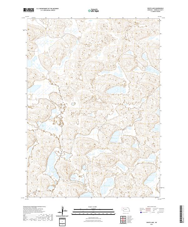
2021 Map of White Lake
USGS Topo · Published 2021About this map
White Lake and a constellation of smaller, named alkali and freshwater basins characterize this portion of Sheridan County in the early 21st century. This Nebraska Sandhills landscape is defined by its lack of established settlements, instead showing a network of primitive tracks like 304 Trl and 213th Trl that navigate between high-relief dunes. The naming of bodies of water such as Jennings Lake, Walters Lake, and O Brien Lake likely reflects early ranching families who established claims in this part of the Great Plains.
Find a feature on this map
16 named features on this map. Tap any name to fly to it.
Don’t see what you’re looking for? This feature index may not catch every label — zoom into the map to look around manually.
Map Details
Editions of this 2021 White Lake Map
This is the sole edition of this map. No revisions or reprints were ever made.
Other maps of this area

1948 · Bingham
USGS Topo · 1:62,500

1948 · Lakeside
USGS Topo · 1:62,500

1948 · Twin Lakes
USGS Topo · 1:62,500

1948 · Spade Ranch
USGS Topo · 1:62,500

1950 · Twin Lakes
USGS Topo · 1:62,500

1950 · Spade Ranch
USGS Topo · 1:62,500

1950 · Lakeside
USGS Topo · 1:62,500

1950 · Bingham
USGS Topo · 1:62,500

1955 · Alliance
USGS Topo · 1:250,000

1957 · Alliance
USGS Topo · 1:250,000