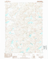
1989 Map of White Lake
USGS Topo · Published 1989About this map
White Lake and a dense network of smaller basins characterize this portion of the Nebraska Sandhills, where the landscape is defined by its unique hydrology and cattle ranching tradition. Recorded in the late 1980s, the area shows a distinct pattern of isolated water bodies, ranging from the prominent O Brien Lake to smaller features like Jennings Lake and Tin Can Lake. The presence of Star Ranch and Wilson Ranch underscores the reliance on this topography for grazing, with property boundaries defined by township and range lines T 26 N and R 43 W. These scattered ranching outposts are connected by a network of unimproved roads and trails, highlighting the geographic isolation and the specialized nature of land use in this part of Sheridan County.
Find a feature on this map
16 named features on this map. Tap any name to fly to it.
Don’t see what you’re looking for? This feature index may not catch every label — zoom into the map to look around manually.
Map Details
Editions of this 1989 White Lake Map
This is the sole edition of this map. No revisions or reprints were ever made.
Other maps of this area

1948 · Bingham
USGS Topo · 1:62,500

1948 · Lakeside
USGS Topo · 1:62,500

1948 · Twin Lakes
USGS Topo · 1:62,500

1948 · Spade Ranch
USGS Topo · 1:62,500

1950 · Twin Lakes
USGS Topo · 1:62,500

1950 · Spade Ranch
USGS Topo · 1:62,500

1950 · Lakeside
USGS Topo · 1:62,500

1950 · Bingham
USGS Topo · 1:62,500

1955 · Alliance
USGS Topo · 1:250,000

1957 · Alliance
USGS Topo · 1:250,000