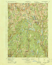
1944 Map of White Lake
USGS Topo · Published 1944About this map
White Lake and the surrounding Sullivan County uplands are defined here by a dense network of glacial water bodies and early 20th-century rural infrastructure. This 1944 War Department update, based on 1920s topography, reveals the significant footprint of the Toronto Reservoir and the Lake Superior area before modern development transformed the region's shoreline. The map documents numerous small school districts, including Mount Hope Sch and Birch Ridge Sch, which served remote settlements like Dutch Settlement and Beaver Brook Corners. The legacy of 19th-century industry is still visible at Falls Mill, while the importance of local heritage is marked by the Stewart Cem and Pintler Cem. Tracing the Newburgh and Cochecton roads shows the vital transit corridor connecting these high-country communities between the Delaware River and the regional hubs of Bethel and Forestburg.
Find a feature on this map
81 named features on this map. Tap any name to fly to it.
Don’t see what you’re looking for? This feature index may not catch every label — zoom into the map to look around manually.
Map Details
Editions of this 1944 White Lake Map
This is the sole edition of this map. No revisions or reprints were ever made.
Other maps of this area

1906 · Port Jervis
USGS Topo · 1:62,500

1908 · Port Jervis
USGS Topo · 1:62,500

1909 · Monticello
USGS Topo · 1:62,500

1910 · Neversink
USGS Topo · 1:62,500

1911 · Monticello
USGS Topo · 1:62,500

1913 · Milford
USGS Topo · 1:62,500

1915 · Milford
USGS Topo · 1:62,500

1920 · Long Eddy
USGS Topo · 1:62,500

1920 · Damascus
USGS Topo · 1:62,500

1921 · Long Eddy
USGS Topo · 1:48,000