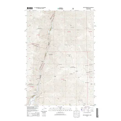
2013 Map of White Monument
USGS Topo · Published 2013About this map
The Snake River carves a deep path through this borderland between Oregon and Idaho, marking the boundary of the Grand Canyon of the Snake River. This landscape is defined by the sharp descent from the heights of Wallowa National Forest and Whitman National Forest down to the river bars. Several small riverside settlements and landings like Fishers Bar, Eagle Bar, and Big Bar suggest the historical reliance on the river for access in an otherwise vertical terrain.
Find a feature on this map
62 named features on this map. Tap any name to fly to it.
Don’t see what you’re looking for? This feature index may not catch every label — zoom into the map to look around manually.
Map Details
Editions of this 2013 White Monument Map
This is the sole edition of this map. No revisions or reprints were ever made.
Other maps of this area

1920 · Seven Devils Mining District
USGS Topo · 1:48,000

1922 · He Devil
USGS Topo · 1:48,000

1954 · Harl Butte
USGS Topo · 1:62,500

1955 · Grangeville
USGS Topo · 1:250,000

1957 · He Devil
USGS Topo · 1:62,500

1957 · Cuprum
USGS Topo · 1:62,500

1957 · Homestead
USGS Topo · 1:62,500

1959 · Grangeville
USGS Topo · 1:250,000

1987 · Riggins
USGS Topo · 1:100,000
1990 · Puderbaugh Ridge
USGS Topo · 1:24,000