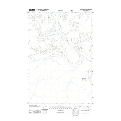
2011 Map of White Mountain
USGS Topo · Published 2011About this map
White Mountain Lookout Tower stands as a primary landmark in this Mineral County terrain, overlooking a network of drainages that define the high country. The landscape is dominated by the confluence of numerous watercourses, including the north-flowing South Fork Fish Creek and the meandering Montana Creek. Settlement patterns are sparse, with the presence of named points like Lion Point and Hamilton Nine suggesting historic lookout sites or localized geographical reference points rather than established towns.
Find a feature on this map
22 named features on this map. Tap any name to fly to it.
Don’t see what you’re looking for? This feature index may not catch every label — zoom into the map to look around manually.
Map Details
Editions of this 2011 White Mountain Map
This is the sole edition of this map. No revisions or reprints were ever made.
Other maps of this area

1911 · Lolo
USGS Topo · 1:250,000

1913 · Lolo
USGS Topo · 1:250,000

1956 · Hamilton
USGS Topo · 1:250,000

1959 · Hamilton
USGS Topo · 1:250,000

1960 · Hamilton
USGS Topo · 1:250,000

1960 · Straight Peak
USGS Topo · 1:62,500

1964 · Hamilton
USGS Topo · 1:250,000

1964 · Lolo Hot Springs
USGS Topo · 1:24,000
1964 · Williams Peak
USGS Topo · 1:24,000
1964 · Deer Peak
USGS Topo · 1:24,000