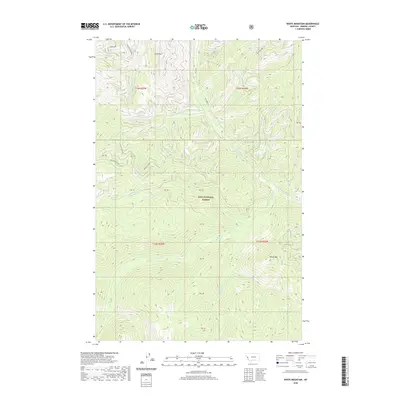
2020 Map of White Mountain
USGS Topo · Published 2020About this map
Lolo National Forest encompasses the high country of Mineral County, defined by a complex drainage network that feeds into the Clark Fork watershed. High elevations are marked by Lion Point in the north and the prominent White Mtn to the southeast. The landscape is primarily shaped by the headwaters of numerous mountain streams, including Surveyors Cr, Montana Cr, and Cache Cr, which carve through the steep terrain. Access to these areas is provided by a system of Forest Development Roads and established routes such as Thompson Creek Rd and Fish Cr Rd. These corridors highlight the early 21st-century management of public lands, where the focus remains on conservation and watershed protection. The intricate contouring reveals the topographical isolation of features like Pebble Cr and White Cr, providing a detailed study of the northern Rocky Mountain wilderness in modern Montana.
Find a feature on this map
26 named features on this map. Tap any name to fly to it.
Don’t see what you’re looking for? This feature index may not catch every label — zoom into the map to look around manually.
Map Details
Editions of this 2020 White Mountain Map
This is the sole edition of this map. No revisions or reprints were ever made.
Other maps of this area

1911 · Lolo
USGS Topo · 1:250,000

1913 · Lolo
USGS Topo · 1:250,000

1956 · Hamilton
USGS Topo · 1:250,000

1959 · Hamilton
USGS Topo · 1:250,000

1960 · Hamilton
USGS Topo · 1:250,000

1960 · Straight Peak
USGS Topo · 1:62,500

1964 · Hamilton
USGS Topo · 1:250,000

1964 · Lolo Hot Springs
USGS Topo · 1:24,000
1964 · Williams Peak
USGS Topo · 1:24,000
1964 · Deer Peak
USGS Topo · 1:24,000