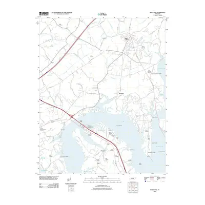
2010 Map of White Pine
USGS Topo · Published 2010About this map
The French Broad river corridor and the sprawling reach of Douglas Lake define the geography of this Jefferson County survey. The landscape is marked by a high density of burial grounds, providing significant genealogical value through sites such as Westminister Cemetery, Swann Chapel Cemetery, and the Jefferson Memorial Gardens Cemetery. Along the shoreline, recreational development is evident at Fanchers Willow Branch Campground and the Swann Lakeside Airpark, while the river's historical navigational challenges are still noted by features like Robinson Ferry Shoals and Copeland Shoals. The town of White Pine serves as the local hub, connected to outlying communities like Baneberry and Kansas by a network of established routes including the Old Airport Rd and Leadvale Rd. This era shows a transition where traditional agricultural terrain at Dutch Bottoms meets contemporary leisure landmarks like the White Pine Golf Course.
Find a feature on this map
113 named features on this map. Tap any name to fly to it.
Don’t see what you’re looking for? This feature index may not catch every label — zoom into the map to look around manually.
Map Details
Editions of this 2010 White Pine Map
This is the sole edition of this map. No revisions or reprints were ever made.
Other maps of this area

1883 · Morristown
USGS Topo · 1:125,000

1893 · Mt Guyot
USGS Topo · 1:125,000

1893 · Morristown
USGS Topo · 1:125,000

1895 · Morristown
USGS Topo · 1:125,000

1912 · Mt Guyot
USGS Topo · 1:125,000

1935 · Newport
USGS Topo · 1:48,000

1935 · White Pine
USGS Topo · 1:24,000

1935 · English Mountain
USGS Topo · 1:48,000

1935 · Clevenger
USGS Topo · 1:24,000

1935 · Springvale
USGS Topo · 1:24,000