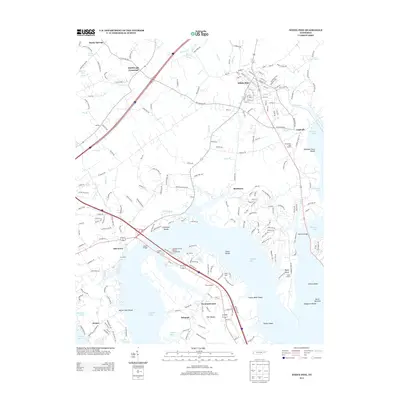
2013 Map of White Pine
USGS Topo · Published 2013About this map
The French Broad River valley and the expansive waters of Douglas Lake dominate this landscape, revealing a region defined by its complex shoreline and historic crossings. The town of White Pine serves as a primary hub in the north, while smaller settlements like Baneberry, Leadvale, and Swannsylvania are scattered across the peninsula and nearby ridges. The mapping of numerous shoals, such as Indian Walk Shoals, Taylor Shoals, and Beaver Dam Shoals, provides a distinct look at the submerged topography of the riverbed before the impoundment of the lake. Local landmarks and family-named points are prevalent, including Kimbrough Crossroad, Swann Bridge, and Halls Corner. From the recreation at White Pine Golf Course to the rural quiet of Dutch Bottoms, the map captures a modern snapshot of Jefferson County, where residential development and the natural river network converge.
Find a feature on this map
218 named features on this map. Tap any name to fly to it.
Don’t see what you’re looking for? This feature index may not catch every label — zoom into the map to look around manually.
Map Details
Editions of this 2013 White Pine Map
This is the sole edition of this map. No revisions or reprints were ever made.
Other maps of this area

1883 · Morristown
USGS Topo · 1:125,000

1893 · Mt Guyot
USGS Topo · 1:125,000

1893 · Morristown
USGS Topo · 1:125,000

1895 · Morristown
USGS Topo · 1:125,000

1912 · Mt Guyot
USGS Topo · 1:125,000

1935 · Newport
USGS Topo · 1:48,000

1935 · White Pine
USGS Topo · 1:24,000

1935 · English Mountain
USGS Topo · 1:48,000

1935 · Clevenger
USGS Topo · 1:24,000

1935 · Springvale
USGS Topo · 1:24,000