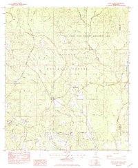
1982 Map of White Plains
USGS Topo · Published 1982About this map
White Plains and the smaller Plains settlement center this survey of the Mississippi piney woods, located where the De Soto National Forest meets the Red Creek State Wildlife Management Area. The landscape is defined by an intricate network of drainage basins, most notably the meandering Tchoutacabouffa River and its major tributaries like Tuxachanie Creek and Hester Creek. This era of the early 1980s shows a region primarily shaped by timber management and conservation, with a sparse road network including White Plains Road and Long Beach Road connecting isolated family-named landmarks. Genealogists will find the locations of Walden Cem and Krohn Cem particularly valuable for tracing local residents in the northern reaches of Harrison and Jackson counties.
Find a feature on this map
33 named features on this map. Tap any name to fly to it.
Don’t see what you’re looking for? This feature index may not catch every label — zoom into the map to look around manually.
Map Details
Editions of this 1982 White Plains Map
This is the sole edition of this map. No revisions or reprints were ever made.
Other maps of this area

1953 · Mobile
USGS Topo · 1:250,000

1954 · Vestry
USGS Topo · 1:62,500

1954 · McHenry
USGS Topo · 1:62,500

1954 · Gulfport North
USGS Topo · 1:24,000

1954 · Ocean Springs
USGS Topo · 1:24,000

1954 · Biloxi
USGS Topo · 1:24,000

1954 · Biloxi
USGS Topo · 1:62,500

1957 · Mobile
USGS Topo · 1:250,000

1960 · Mobile
USGS Topo · 1:250,000

1963 · Mobile
USGS Topo · 1:250,000