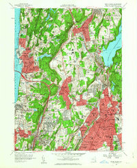
2023 Map of White Plains
USGS Topo · Published 2023About this map
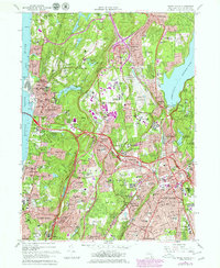
White Plains serves as a dense suburban and institutional hub in central Westchester County, defined by its complex network of parkways and residential hills. The landscape is notably dominated by expansive memorial grounds and cemeteries, including the massive Kensico Cem and Gate of Heaven Cem near Hawthorne, alongside White Plains Rural Cem and Ferncliff Cem. These sites, along with the Westchester County Courthouse, anchor the region's historical and administrative identity.
Find a feature on this map
92 named features on this map. Tap any name to fly to it.
Don’t see what you’re looking for? This feature index may not catch every label — zoom into the map to look around manually.
Map Details
Editions of this 2023 White Plains Map
This is the sole edition of this map. No revisions or reprints were ever made.
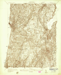
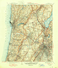
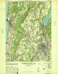
Historical Maps of Valhalla Through Time
6 maps found