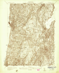
1932 Map of White Plains
USGS Topo · Published 1932About this map
The dense grid of White Plains anchors the southeastern corner of this Westchester County landscape, showing the city's significant expansion just before the mid-century. This 1932 survey captures a transition in land use, where large institutional holdings and social infrastructure define the terrain. Notable landmarks like the Bloomingdale Asylum, Grasslands Hospital, and the Westchester Penitentiary occupy significant acreage, reflecting the era's concentration of regional services in this area.
Find a feature on this map
127 named features on this map. Tap any name to fly to it.
Don’t see what you’re looking for? This feature index may not catch every label — zoom into the map to look around manually.
Map Details
Editions of this 1932 White Plains Map
This is the sole edition of this map. No revisions or reprints were ever made.
Other maps of this area

1891 · Harlem
USGS Topo · 1:62,500

1892 · Stamford
USGS Topo · 1:62,500

1892 · Tarrytown
USGS Topo · 1:62,500

1893 · Stamford
USGS Topo · 1:62,500

1893 · Tarrytown
USGS Topo · 1:62,500

1897 · Harlem
USGS Topo · 1:62,500

1897 · Oyster Bay
USGS Topo · 1:62,500

1898 · Harlem
USGS Topo · 1:62,500

1898 · Oyster Bay
USGS Topo · 1:62,500

1899 · Stamford
USGS Topo · 1:62,500