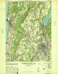
1947 Map of White Plains
USGS Topo · Published 1947About this map
White Plains and the surrounding Westchester corridor appear here in a post-war landscape defined by sprawling institutional grounds, country clubs, and established riverfront estates. The eastern edge is anchored by the Kensico Reservoir and the massive Kensico Cemetery, while the western boundary follows the Hudson River through Tarrytown and Phillipse Manor. This era shows a high density of specialized facilities, from the Bloomingdale Asylum and Burke Foundation in the south to the Westchester Penitentiary and Grassland Hosp near Valhalla.
Find a feature on this map
99 named features on this map. Tap any name to fly to it.
Don’t see what you’re looking for? This feature index may not catch every label — zoom into the map to look around manually.
Map Details
Editions of this 1947 White Plains Map
This is the sole edition of this map. No revisions or reprints were ever made.
Other maps of this area

1891 · Harlem
USGS Topo · 1:62,500

1892 · Stamford
USGS Topo · 1:62,500

1892 · Tarrytown
USGS Topo · 1:62,500

1893 · Stamford
USGS Topo · 1:62,500

1893 · Tarrytown
USGS Topo · 1:62,500

1897 · Harlem
USGS Topo · 1:62,500

1897 · Oyster Bay
USGS Topo · 1:62,500

1898 · Harlem
USGS Topo · 1:62,500

1898 · Oyster Bay
USGS Topo · 1:62,500

1899 · Stamford
USGS Topo · 1:62,500