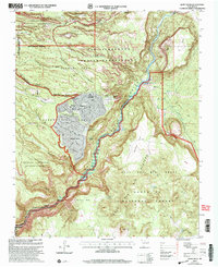
2002 Map of White Rock
USGS Topo · Published 2003About this map
The White Rock residential community and neighboring Pajarito Acres sit atop a plateau deeply etched by a network of drainage systems, including Pajarito Canyon and Potrillo Canyon. This 2002 revision by the Forest Service highlights the complex jurisdictional boundaries of northern New Mexico, where the Los Alamos National Laboratory facility meets the San Ildefonso Indian Reservation and the Ramon Vigil Grant.
Find a feature on this map
45 named features on this map. Tap any name to fly to it.
Don’t see what you’re looking for? This feature index may not catch every label — zoom into the map to look around manually.
Map Details
Editions of this 2002 White Rock Map
This is the sole edition of this map. No revisions or reprints were ever made.
Other maps of this area

1892 · Santa Clara
USGS Topo · 1:125,000

1951 · Agua Fria
USGS Topo · 1:24,000

1952 · White Rock
USGS Topo · 1:24,000

1952 · Frijoles
USGS Topo · 1:24,000

1952 · Puye
USGS Topo · 1:24,000

1952 · Montoso Peak
USGS Topo · 1:24,000

1952 · Guaje Mountain
USGS Topo · 1:24,000

1953 · Espanola
USGS Topo · 1:24,000

1953 · Cochiti Dam
USGS Topo · 1:24,000

1953 · Horcado Ranch
USGS Topo · 1:24,000