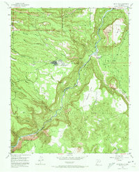
1952 Map of White Rock
USGS Topo · Published 1973About this map
Bandelier National Monument and the San Ildefonso Indian Reservation meet along the deeply incised basalt and tuff plateaus of the Pajarito Plateau during the early 1950s. The settlement of White Rock sits at the center of a complex topography defined by the Rio Grande and its numerous tributary canyons, including Los Alamos Canyon and Mortandad Canyon. The landscape preserves significant archaeological evidence, marked by the Tsankawi Ruins, Navawi Ruins, and Tshirege Ruins, alongside remnants of earlier infrastructure like the Old Railroad Grade. This survey illustrates the area's transition into the atomic era, showing an Artesian Well and now-defunct facilities such as the Pumping Station (Aband) and Pueblo Tank (Aband) near the confluence of Chaquehui Canyon and the river. Large land grants, including the Ramon Vigil Grant and Caja del Rio Grant, still define the territorial boundaries of the region.
Find a feature on this map
40 named features on this map. Tap any name to fly to it.
Don’t see what you’re looking for? This feature index may not catch every label — zoom into the map to look around manually.
Map Details
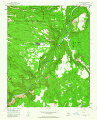
Editions of this 1952 White Rock Map
3 editions found
Other maps of this area

1892 · Santa Clara
USGS Topo · 1:125,000

1951 · Agua Fria
USGS Topo · 1:24,000

1952 · White Rock
USGS Topo · 1:24,000

1952 · Frijoles
USGS Topo · 1:24,000

1952 · Puye
USGS Topo · 1:24,000

1952 · Montoso Peak
USGS Topo · 1:24,000

1952 · Guaje Mountain
USGS Topo · 1:24,000

1953 · Espanola
USGS Topo · 1:24,000

1953 · Cochiti Dam
USGS Topo · 1:24,000

1953 · Horcado Ranch
USGS Topo · 1:24,000